File:RM Map Example.png
Revision as of 19:13, 1 November 2022 by Diana.fred (talk | contribs) (Example of using an RM map to assist in determining land ownership)
Size of this preview: 800 × 498 pixels. Other resolutions: 320 × 199 pixels | 1,520 × 946 pixels.
Original file (1,520 × 946 pixels, file size: 1.16 MB, MIME type: image/png)
Summary
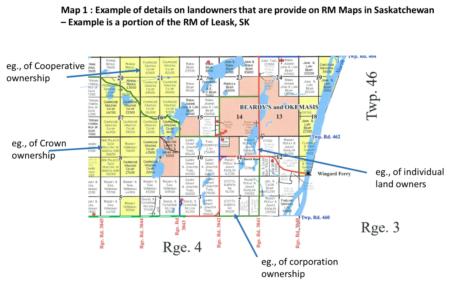
Example of using an RM map to assist in determining land ownership
File history
Click on a date/time to view the file as it appeared at that time.
| Date/Time | Thumbnail | Dimensions | User | Comment | |
|---|---|---|---|---|---|
| current | 19:13, 1 November 2022 | | 1,520 × 946 (1.16 MB) | Diana.fred (talk | contribs) | Example of using an RM map to assist in determining land ownership |
You cannot overwrite this file.
File usage
There are no pages that use this file.